Well it has been coming, I’ve felt a dull acre in my bones – some far way light I just have to move towards. After a 6 months break I’ve started my historical research again.. For those of you who are not aware I researching the routes of pre historic salt ways (in England that is usually seen as pre 43 AD or CE)

I’m currently looking at a small village in the north east of Leicestershire called Saltby. The reason for my interest is the name which would indicate that there was some sort of connection with Salt but that is unknown. The village has a mineral spring which some have taken to be the source of the Salt element in the name. However, when you examine this you very quickly realise that whilst the spring has a ‘salt’ element it has nothing to do with Sodium Chloride so this is unlikely to be the source of the name.
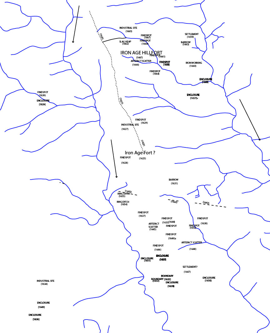
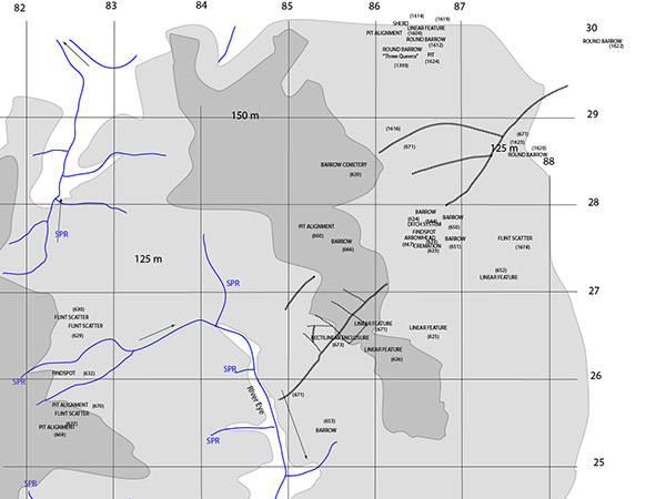
Instead I believe it sits on an undiscovered salt route from the Lincolnshire fens and I have been trying to prove this. To do this I’ve been trying to rebuild the prehistoric landscape by looking at geographical and topological features, examing the archaeological record and then plotting them on a map.

I also look at the available air photography, which we are now blessed with a unrivalled supply. This image is from Bing because it really shows the crop marks up that run village towards the village of Wyville. The archaeological records mention these features but doesn’t really give any explanation as to what they are. However, from examining the information I suspect that this are drove tracks for animals to be taken off of the heath, which being on top of porous rocks is very dry.
Once you’ve done all this you then have to look at the bigger picture and then try to work out how this fits into the hypothesis you are working on at the moment. It takes time and, in truth, you’ll never have the full answer because we talking about over 2000 years ago and no matter how much you think you know you know very little. However, it can be really absorbing and hours just seem to disappear.