One of the problems when you are researching the landscape is that you can very easily follows paths that lead nowhere. Today was one of those days. I spent most of the day in the south Lincolnshire fens looking at saltways and all things salt. Threekingham is the key to my research in this area because when the fens were, well, fens this was the last piece village of any substance before descending into the fens when travelling to Boston. Today it is just another small village bypassed but then it was the gateway to hell. Over selling it a little I know but the fens must have seemed very unsafe even when using a well used roads and tracks.
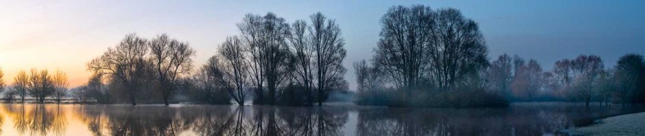
Threekingham church is a really impressive building. Even more impressive is the spire which I thought was added much later than the medieval period but it seems I was wrong. Indeed the only other tall building you can see with the naked eye from the fens is the Boston Stump and it may be that this was deliberate – signs of safety whilst crossing the fens or this is just whimsy on my part? Probably.
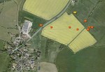
After Threekingham and the old fair ground at Stowe I made my way home via Melton. On the way over I had noticed a distinctive hollow in a field and I thought I would examine this one the way home – it was a nice day so there was no rush I thought. Bad move. As I was driving home it rained and rained but this being summer the rain didn’t last for long. So by the time I got to the field the sun was out so what would be better than a walk across the fields. Nothing apart from the fact that one of the field was filled with half grown wheat which have wonderfully full leaves, capable of capturing an awful lot of water. Needless to say by the time I had crossed the field I was saturated. Still the feature really worth it, well at least if you are a landscape archaeologist which I sort of am, otherwise it was just a dip in a hill and nothing to write home about. The dip was caused by many thousands of people walking across the field for hundreds of years and is known as a hollow way.
Now there was only problem with this and all the time as a walked across the field it was lurking at the back of my mind. Great hollow way but is it in the right place for my purposes? As I was in the field I couldn’t say but I duly examined the feature and then made a hasty retreat as more rain was on the way – this time taking a slightly less damp way back – only slightly. I got back to the car, wiped myself down and drove home through the rain and hail, don’t you just love the english summer! Well I have now had a chance to sit down and look at the maps at home and my doubts were legitimate – the hollow way was in the wrong place or at least for my current understanding of the situation. More work required me thinks.
Oh one final thing. Using the iPhone to capture images for research is really great. All the images are geotagged as you go along and so you don’t have to work out where you were when you captured the image. Now other smartphones do this but I work with the iPhone so I can only talk about the iPhone.
Simon Marchini
Web: http://WWW.simonmarchini.co.uk
-

- brentingby 0002
-

- threekingham church 0001
-

- holloway 0001
-
- untitled
